Pueblo Precincts Maps (Click title below)
• Map of Pueblo Precinct Boundaries
• Pueblo Precincts Interactive Maps
• Detailed Maps of Individual Pueblo Precincts
U.S. Congressional Districts in Colorado
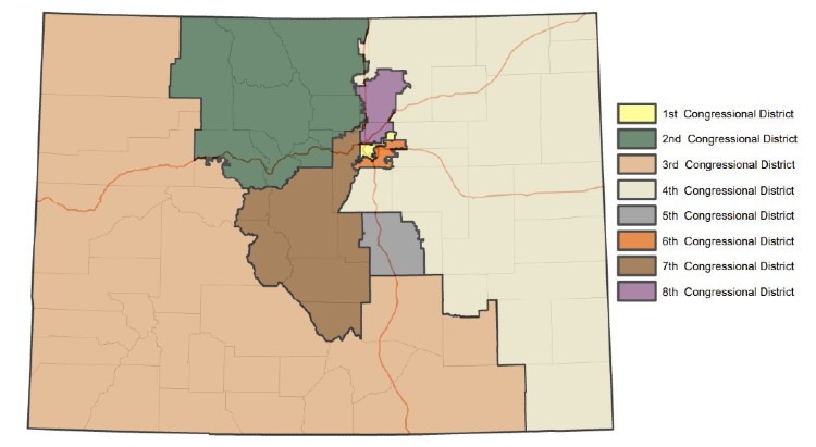
Interactive U.S. Congressional map here.
Use the +/- links in the upper left corner to zoom in/out, or type in your street address and zip in the search window.
Colorado State Senate Districts
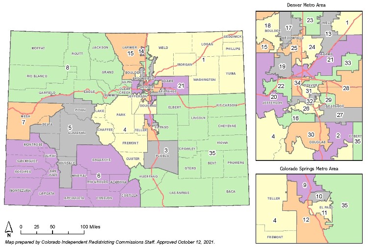
Interactive State Senate map here.
Use the +/- links in the upper left corner to zoom in/out, or type in your street address and zip in the search window.
Colorado State House Districts
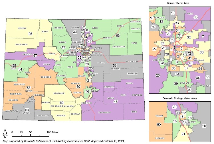
Interactive State House map here.
Use the +/- links in the upper left corner to zoom in/out, or type in your street address and zip in the search window.